GIS stands for Geographic Information System, and the study uses computerized technology to ascertain data related to the Earth’s surface. GIS captures, stores, manipulates, checks, and analyzes all forms of geographical data. You can get your hands on a GIS certification course, master the niche if you are interested in forest management, cartography, environmental sciences, and urban planning.
GIS training teaches you how to map things, densities, and quantities. You can also use GIS to ascertain what is inside a particular area or region and its features. Online learning courses have made it easy to get thorough knowledge on a subject from the comfort of your homes. Avail of GIS certificate programs online if you want a flourishing career in landscape architecture, real estate, community planning, and public health.
Why Do GIS Certification?
GIS technology has a significant impact on the current world scenario. It is used in a wide range of applications and is a viable career option. GIS studies trends and relationships about regions and areas and is used in decision making and problem-solving in domains like real estate appraisal, banking, emergency management, and retail. It also helps natural resources management personnel and business owners in making crucial decisions.
GIS classes facilitate students to learn about the under-served population lying within a community. They also identify geographical risks and enable better communication during crisis management. Proper analysis of facts sourced from the GIS leads to propagating transparency from government officials during natural calamities. Since you know from beforehand what is going to occur is a geographical location, you can plan the course of action prior. GIS also leads to easy record-keeping of climatic change data.
Top 8 GIS Certification Courses You Must Check Out
Online GIS certificate programs teach students to display data in graphic visual representations and is meant for anyone interested in geography. Even if you want to work in fields like homeland security, transportation, social sciences, water resources, and map making, a GIS certification online goes a long way in boosting your career.
We’ve researched and enlisted the best GIS courses that will expose you to various practical applications of the subject and make you a thorough professional. These GIS certificate courses and online classes are sourced from note-worthy learning portals that boast exceptional teaching panels.
1. Core Spatial Data Analysis: Introductory GIS with R and QGIS from Udemy
The GIS certification course from Udemy makes you an expert in spatial data analysis. You learn how to use QGIS and R by getting your hands on a real project. It is an introductory class meant for anyone looking forward to getting a job in spatial data. Instructor Minerva Singh is a best-selling teacher at Udemy and a data scientist who brings her expertise to the table.
If you find GIS books confusing and expensive, resort to this online tutorial, and you won’t be disappointed. You understand basic concepts from scratch in simple terms and the process of automating GIS tasks. The 2.5-hour hands-on course spends little time teaching theoretical concepts and focuses mostly on practical applications of spatial data analysis in real-life scenarios.
Key Highlights
- Clear basic concepts about spatial data
- Learn how to process vector and raster data using free software like QGIS and R
- Understand the process of carrying out practical spatial data analysis tasks
- Analyze spatial data
- Avail of handy tips to avoid glitches
Online course duration: 2.5 hours
No. of students enrolled: 8600+
Ratings: 4.3
Completion certificate: Yes
Best suited for – Conversation managers and researchers.
Check price and sign up for Core Spatial Data Analysis: Introductory GIS with R and QGIS
2. Geographic Information Systems (GIS) Specialization from Coursera
The specialization course from Coursera teaches students the art of analyzing spatial data and the usage of the GIS software in a professional setting. You create maps and understand cartography techniques to communicate and represent the data obtained from maps. The GIS certification gives you enough knowledge to level up with your peers working in similar fields.
Once you learn the basic concepts and understand all the crucial topics well, you participate in a hands-on project at the end of the tutorial. One of the best GIS certificates online; this one from Coursera, is ideal for beginners since the course structure strikes a balance between theory and practical expertise. You also come to terms with GIS terminology and explore tools used in spatial data analysis.
Interactive videos, proper instructions, self-paced lessons, and a professional portfolio in the end; what more can you ask? So, are you game to map your world with GIS?
Key Highlights
- Master the art of creating and working with raster data
- Interpret and explain the results of spatial data analysis
- Get to know everything about geospatial analysis and work on projects
- Work with ModelBuilder
- Setup the GIS software and navigate through the interface
- Identify and geographical collect data
- Understand analytical map development
- Create a professional portfolio to advance your career in related fields
Online course duration: 7 hours per week/6 months to complete
No. of students enrolled: 39000+
Ratings: 4.9
Completion certificate: Yes
Best suited for – GIS beginners
Price: 7-day free trial/buy the plan for $49 per month
Sign up for Geographic Information Systems (GIS) Specialization
3. Using Open Source Tools To Create an Enterprise GIS from Udemy
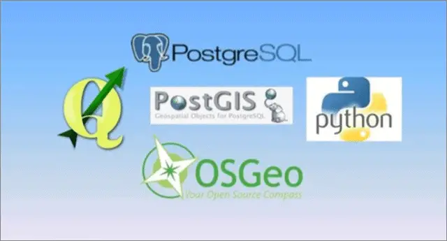
If you are already well-versed with GIS basics, take up this GIS certification course from Udemy and move to the next level by unlocking a new achievement. You learn how to create an enterprise GIS using various open-source tools like PostGIS, PostGres SQL, and QGIS. By the end of the tutorial, you will master the art of managing and handling users, and supporting different GIS software clients.
Key Highlights
- Learn how to install PostGres and PostGIS
- Understand the process of loading GIS
- Perform geographic analysis by issuing spatial and non-spatial SQL
- Learn how to attribute data into PostGIS and PostGres
- Design a PostGres database
- Understand how to edit GIS data that is being used by multiple users
- Include constraints and indexes to manage data
- Learn how to develop a kiosk in Python
Online course duration: 3.5 hours
No. of students enrolled: 3500+
Ratings: 4.3
Completion certificate: Yes
Best suited for: Whoever wants to create enterprise GIS
Check price and sign up for Using Open Source Tools To Create an Enterprise GIS
4. Real-World GIS from LinkedIn Learning
Students who have a strong base in GIS and are highly knowledgeable about the workings of the field, but wondering how to put the skills to use, must avail of this GIS certification course from LinkedIn Learning. The training program helps students in overcoming this dilemma and makes them work in practical scenarios. You learn how to find solutions to common problems one might encounter as a field professional.
Are you ready to acquire techniques that will help you in spatial analysis and cartography?
Key Highlights
- Access data in catalog and proprietary formats
- Work with graticules and projections
- Collect geospatial data
- Create a GIS project from scratch
- Explore GIS trends
- Understand GIS data formats
Online course duration: 2 hours 43 mins
No. of viewers: 39000+
Completion certificate: Yes
Best suited for – GIS specialists, geologists, and intermediate level students
Price: Free
Sign up for Real-World GIS from LinkedIn Learning
5. GIS: Understand the Theory and Practice GIS QGIS from Udemy

To master any subject, it is first essential to get the theory right. This GIS certification course teaches you the fundamental concepts, and once through, you avail of hands-on practical training on working with maps. The 2.5-hour tutorial sees to it that students also master the art of analyzing spatial data in QGIS.
By the end of the training program, you will understand the nitty-gritty of GIS technology well and also feel more confident about working with the GIS software. You learn how to create maps from scratch and complete projects on your own that require detailed data analysis. The practice activities help you in checking and implementing what you’ve learned.
Key Highlights
- Thoroughly understand the workings of GIS
- Geocode addresses
- Learn the process of working with raster and vector data
- Clear, ascertain, and map GIS data
- Get to know about remote sensing technologies
- Learn how to perform various GIS operations, for example, clipping
- Understand how QGIS works
- Build a web map
- Acquire, process, visualize and analyze GIS data
- Learn everything about reference systems and map projections
Online course duration: 2.5 hours
No. of students enrolled: 3200+
Ratings: 4.1
Completion certificate: Yes
Best suited for – Social scientists, programmers, biologists, geologists.
Check price and sign up for GIS: Understand the Theory and Practice GIS QGIS
6. GIS on the Web from LinkedIn Learning
With advanced web-mapping technology like Google Maps joins hands with GIS, the product you get is more productive and insightful. You also gain valuable insights into your data. In this GIS certification program, you understand the workings of tools that teach you the methods of analyzing geodata and come up with interactive mobile maps. You learn how to work with mapping technologies and communicate your ideas more effectively.
The information you thus grab from the training helps you in creating multi-layered visualizations that form an integral part of mapping techniques used in Bing Maps and Google Maps, for example. Share and publish your work, participate in exciting challenges, get prompt feedback, and enhance your resume.
Key Highlights
- Understand map mashups
- Learn mapping with Google Drive
- Find coordinates
- Master GIS fundamentals and get your hands on practical knowledge
- Analyze maps and merge data
- Learn how to geocode with coordinates and addresses
- Create interactive mobile-ready apps
- Work with Bing Maps on Google Maps
- Publish and share your work
Online course duration: 2 hours 8 mins
No. of viewers: 7900+
Completion certificate: Yes
Best suited for – GIS specialists, test development engineers, and software developers
Price: 1-month free trial/buy the subscription for $29.99 per month
Sign up for GIS on the Web from LinkedIn Learning
7. Getting Started with GIS from Esri
Anyone in the lookout for building a strong GIS foundation must avail of this Esri certification tutorial. The course is primarily designed to help students understand the basic concepts of the field. Students develop the required skills and get their hands-on techniques and ideas that cover GIS holistically. Once the GIS certification course is over, you implement what you’ve learned and worked with maps.
Understand geographical data with the carefully-crafted tutorial. Get acquainted with the interface, install the software, and acquire valuable skills. Create a map, evaluate data, learn about patterns, and receive constant feedback. Enhance your portfolio, add useful knowledge, showcase your work, and be job-ready.
Key Highlights
- Create and visualize information that facilitates problem-solving and decision-making.
- Get an introduction to the basic concepts
- Learn techniques that underlie GIS
- Experience working with geographical data and maps
- Create a GIS map
- Visually analyze features, patterns, and relationships on GIS maps
- Evaluate data that is used in mapping projects
- Analyze results and share GIS maps
Online course duration: 3 hours 30 mins
Ratings: 4
Best suited for Beginner and intermediate levels
Price: Free
Sign up for Getting Started with GIS from Esri
8. Introduction to Geographical Information Systems from Skillshare

The GIS certification course from Skillshare introduces you to the niche and is ideal for beginners. You get your hands on the latest GIS technologies and brush up both theoretical knowledge and practical expertise. The video lectures are easy to follow, and in the end, you get to practice what you’ve learned via laboratory exercises.
You understand GIS data structure and learn about the sources of GIS data. Students get to know the workings of the Google Earth Engine platform by analyzing massive amounts of visual geospatial data. You also get your hands on crucial techniques that enable you to utilize and manipulate GIS data to meet your ends. So, are you ready to acquire skills that will help you in manipulating Earth observation data?
Key Highlights
- Get a thorough introduction to GIS
- Learn how to utilize GIS technologies to make decisions
- Understand everything about GIS data structure and sources of GIS
- Visualize and analyze geospatial data
- Observe and manipulate GIS data
- Learn about various practical GIS applications
Online course duration: 17 mins
No. of students enrolled: 330+
Best suited for GIS beginners
Price: Premium Skillshare account needed
Sign up for Introduction to Geographical Information Systems
Conclusion
Geographical Information System or GIS analyzes, manages, views, and displays information about geographic data. GIS enables users to get their hands on maps and charts and ascertain spatial details about specific areas and regions. You can formulate reports and charts from the data thus collected and represent it visually. GIS helps users in problem-solving and decision-making.
GIS is extensively used in environmental geography and physical geography. If you see yourself working in sectors like public health and community planning, getting a GIS certification done helps. Transportation geography, health geography, and economic geography are other sub-branches where GIS serves essential purposes. After adding a GIS certification to your resume, you can also apply for jobs in sectors like landscape architecture, real estate, and natural resource management.


